


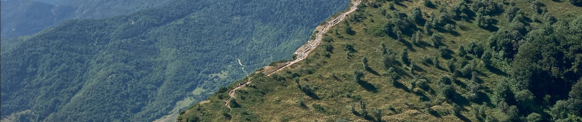
Les trois becs

Lobin
User
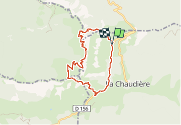

Length
7.6 km

Max alt
1565 m

Uphill gradient
724 m
Km-Effort
17.2 km

Min alt
913 m

Downhill gradient
727 m
Boucle
Yes
Creation date :
2025-07-05 07:05:04.0
Updated on :
2025-07-05 10:35:02.303
3h29
Difficulty : Difficult

FREE GPS app for hiking
 SityTrail
IGN / Geographical institutes
SityTrail Plus
The world is yours!
About
Trail Walking of 7.6 km to be discovered at Auvergne-Rhône-Alpes, Drôme, La Chaudière. This trail is proposed by Lobin.
Photos


Positioning
Country:
France
Region :
Auvergne-Rhône-Alpes
Department/Province :
Drôme
Municipality :
La Chaudière
Location:
Unknown
Start:(Dec)
Start:(UTM)
675310 ; 4945545 (31T) N.
Comments